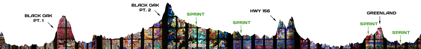
This 52-mile southside route features the classic Black Oak loop, but instead of riding all the way back into town on Highway 71, the route turns west over the old “green” bridge and heads north through West Fork for a water stop at the gas station before backtracking toward Hogeye and coming back into town on Highway 265.
There are four city limit sprint signs, and an optional water stop with restrooms at Brentwood Park.
Sprint Signs:
Mile 24.2 – Hwy 71 – Brentwood city limit
Mile 29.8 – McKnight Avenue – West Fork city limit
Mile 45.5 – Hwy 265 – Greenland city limit
Mile 48.2 – Hwy 265 – Fayetteville city limit